
Tenchijin – Japan's Leading Satellite Tech Company to Develop its own Satellite and Launch in 2027
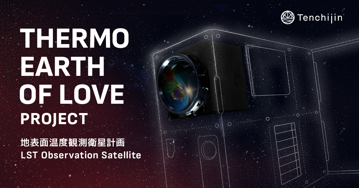
“Thermo Earth of Love Project” to Enhance Surface Temperature Observation and Advance its Solutions Further
TOKYO, JAPAN - Media OutReach Newswire - 20 February 2025 - On January 27, 2025, Tenchijin announced the launch of “Thermo Earth of Love Project," a proprietary satellite program aimed at enhancing surface temperature monitoring capabilities.The company's satellite is scheduled for launch in 2027.
has been utilizing satellite data to tackle various societal challenges, including climate change mitigation, aging infrastructure, and urban planning. Among the extensive range of satellite data, Tenchijin places particular importance on surface temperature data.
Surface temperature has been one of the key satellite data types Tenchijin has worked with since its founding. As Tenchijin has collaborated with stakeholders such as agricultural producers, local governments, and water utilities to address their challenges, it has recognized the growing importance of this data. In recent years, with increasingly severe summer heatwaves, knowing not only air temperature but also ground heat level has become even more critical. Tenchijin believes that surface temperature data is essential for understanding the impacts of climate change, assessing disaster risks, and developing effective countermeasures.
It is this belief in the potential of surface temperature data that led the company to take the significant step of developing its own satellite. The project name "Thermo Earth of Love Project" symbolizes both the warmth of Earth that surface temperature data reveals (Thermo Earth) and Tenchijin's love and dedication to the planet (Love).
Continuous observation and analysis of surface temperature from space allow us to reexamine the relationship between Earth and humanity from the ground up. By making surface temperature data a standard part of society and transforming it into solutions that enhance people's lives with greater safety and security, Tenchijin aims to contribute to a better future for the next generation.
When people think of satellite data, satellite imagery (visible images) is often what comes to mind. Many private companies, both in Japan and abroad, provide satellite imagery. At Tenchijin, these images are used to monitor natural changes, detect urban development, and identify structures and other features.
SAR Imagery
Satellite imagery can also capture information that is invisible to the human eye. One example is Synthetic Aperture Radar (SAR) imagery, which has recently gained attention. While SAR satellites like Japan Aerospace Exploration Agency (JAXA)'s advanced radar satellite "Daichi-4" (ALOS-4) have traditionally been developed under government initiatives, private companies have also started entering the field. Tenchijin uses SAR data to analyze ground deformation and related phenomena.
Surface Temperature
Surface temperature refers to the temperature of the ground itself. Unlike air temperature, which measures the temperature of the atmosphere, surface temperature indicates how hot or cold the ground is.
Surface temperature is a specialized dataset collected by various national satellites, including those from the Japan Meteorological Agency, JAXA, and NASA. Traditionally, this data has primarily been used by scientists and researchers.
However, since its founding, Tenchijin has been applying surface temperature data to business use cases. The reason why this data had not been widely adopted in business before lies in its complexity and the rarity of overlaying multiple satellite datasets.
Why has Tenchijin been able to leverage this data?
The answer lies in the company's name. The name "Tenchijin" embodies its core mission:
"Ten" (Sky): utilizing satellite data from space
"Chi" (Earth): integrating ground-based data
"Jin" (People): enhancing people's lives and activities through data
Because Tenchijin was founded with a vision of integrating multiple data sources, the company was able to quickly realize the potential of surface temperature data.
Surface temperature plays a crucial role in Tenchijin's existing services, such as evaluating the risk of infrastructure deterioration, selecting optimal locations for renewable energy, and assessing suitable areas for agriculture adapted to climate change.
Recognizing the value of surface temperature data early on, Tenchijin has been conducting research and development to create proprietary high-frequency, high-resolution surface temperature information. This involves integrating data from JAXA's GCOM-C satellite, the Himawari weather satellite, and various international satellites.
We are currently utilizing this technology in the free-to-use WebGIS service called "Tenchijin COMPASS" and in the water utility DX service for local governments and water service providers, known as "Tenchijin COMPASS KnoWaterLeak."
Starting in 2027, expanded coverage and higher resolution surface temperature data will significantly advance our solutions. We envision specific applications in the following areas:
Enhancements in Water Infrastructure Management
High-resolution, high-frequency surface temperature data will enable more advanced maintenance and management of water infrastructure. This includes improving leak detection accuracy, providing near-real-time monitoring for rapid response, and enabling the prediction and preventive maintenance of water pipes. Additionally, this data will be utilized to assess damage from earthquakes and volcanic eruptions, contributing to urban planning and disaster management efforts.
Precision Agriculture
By leveraging more detailed surface temperature data, we can enable precise monitoring of crop growth conditions, early detection of pests and diseases, and optimal selection of crop varieties. Near-real-time analysis of climate change and soil temperature variations will enhance the accuracy of harvest planning, supporting the development of sustainable agricultural models.
"Thermo Earth of Love Project" represents a bold step for Tenchijin, a startup that has previously deployed satellite data-driven solutions, as it now ventures into the domain of space hardware development.
In the space hardware sector, business models have traditionally been hardware-driven, where companies develop their own satellites and sell the resulting observation data. However, Tenchijin's solution-driven vertical integration approach is a rare and pioneering initiative, even on a global scale.
Tenchijin's strength lies in knowing the data required through real-world business applications. By identifying data that can effectively address societal challenges, Tenchijin believes it can fully unlock its value.
Surface temperature data, in particular, is a specialized form of information monitored by government satellites, such as those from the Japan Meteorological Agency, JAXA, and NASA. This is precisely why it is significant for not only government agencies but also private companies to possess and utilize this data, broadening its potential applications.
Tenchijin is guided by its mission of "optimizing human civilization through space big data" and its core values of "thinking from a space perspective" and "engaging in activities beneficial to Earth." "Thermo Earth of Love Project" is a major step toward achieving these high aspirations.
The satellite data capturing Earth's state holds limitless possibilities. "Thermo Earth of Love Project" expresses both the warmth of surface temperature and a deep love for the planet.
Tenchijin firmly believes that surface temperature data is an invaluable resource for humanity. Tenchijin sincerely hopes you will follow and support the challenges it faces in "Thermo Earth of Love Project."
Hashtag: #Tenchijin #Space #SatelliteTechnology #SurfaceTemperature
https://tenchijin.co.jp/?hl=en
https://www.linkedin.com/company/tenchijin/?hl=en
https://x.com/tenchijin_pr?hl=ja
https://www.facebook.com/tenchijin.pr?hl=ja
The issuer is solely responsible for the content of this announcement.
Tenchijin, Inc.
E-Mail: info@tenchijin.co.jp (person in charge of communication: Keisuke Sunagare)