
our voyage investigating Australia's submarine landslides and deep-marine canyons
- Written by: Hannah Power, Associate Professor in Coastal and Marine Science, University of Newcastle
Environmental scientists see flora, fauna and phenomena the rest of us rarely do. In this series, we’ve invited them to share their unique photos from the field.
We gathered at the edge of the ship deck, awaiting the return of our sediment corer that had been lowered 4.5 kilometres – half the height of Mount Everest – to the seafloor. Our team of 53 people nervously shuffled together like penguins as we speculated about what we’d find.
It was July 2022. We’d been at sea for 36 days on CSIRO’s Research Vessel Investigator to explore the edges of our continent and learn how it evolved through time. While we’re all familiar with the shape of modern Australia, our continental mass actually extends well beyond our shorelines.
Over the 36 days of our voyage, we mapped more than 40,000 square kilometres of the seafloor from as shallow as 22 metres to depths of over 4.8km. And we’ve created 3D visualisations of features never seen before.
The steel corer emerged from the deep glistening like pirate treasure. It marks just one of many samples we collected at sea. Analysing them all will probably take years, but we can still share exciting new maps of the seafloor and what they may reveal – from the threat of tsunami in Australia to evidence of ancient beaches and dunes.
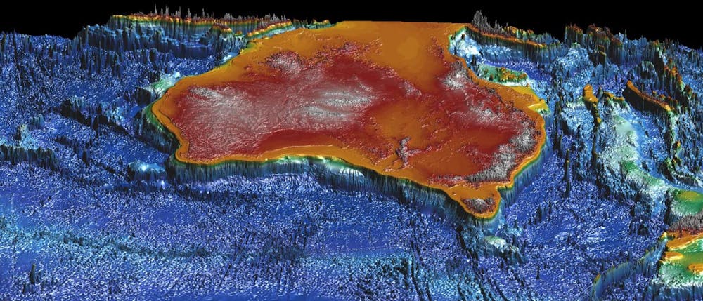
The threat of tsunami
Our research voyage aimed to investigate how mud and sand flows from our continent into the deep oceans. Along the way, these different sediments can travel down submarine canyons and form large landslides.
Sometimes, these submarine landslides are large enough to trigger a tsunami – so we’re also working to understand what the local tsunami risk is for Australia’s eastern seaboard communities.
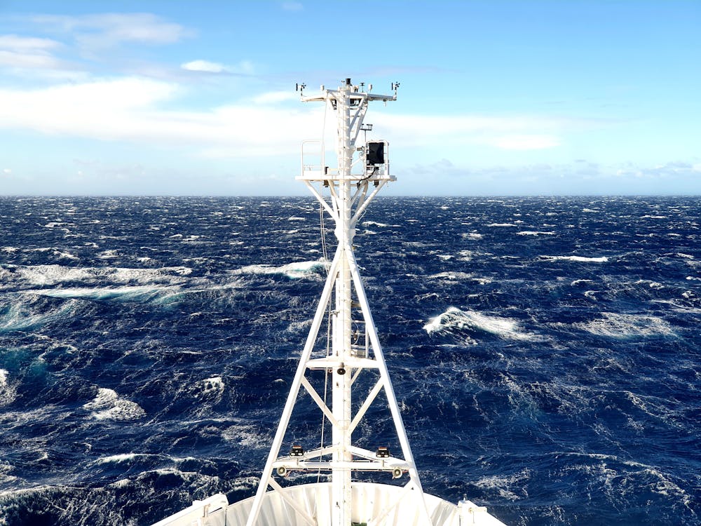 The weather at sea isn’t always clear and calm. Early on in the trip we experienced winds of up to 50 knots.
Mike Kinsela, Author provided
The weather at sea isn’t always clear and calm. Early on in the trip we experienced winds of up to 50 knots.
Mike Kinsela, Author provided
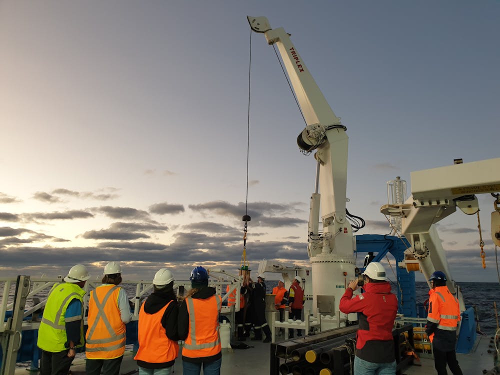 Two Argo floats will be part of an international program consisting of a fleet of robotic instruments that drift with the ocean currents to collect information from inside the ocean. Here you can see an Argo float being deployed at dawn while the night shift scientists watch on.
Mike Kinsela, Author provided
Two Argo floats will be part of an international program consisting of a fleet of robotic instruments that drift with the ocean currents to collect information from inside the ocean. Here you can see an Argo float being deployed at dawn while the night shift scientists watch on.
Mike Kinsela, Author provided
A big part of understanding the potential threat of tsunami is learning how the material from the submarine landslides along the eastern seaboard has moved down into the deep ocean. For example, does it go as a single, large slab of sediment, failing all at once? Or does it slowly break apart, with smaller pieces heading down slope one at a time as a slurry of sediment and water?
While Australia has a relatively low tsunami risk compared to other places around the world, we are still exposed and so should heed warnings from emergency services.
A recent tsunami to hit Australia was caused by the underwater volcanic explosion in Tonga in January last year. This brought waves of more than 80 centimetres to the Gold Coast, which could knock you off your feet.
 This satellite image shows an undersea volcano eruption at the Pacific nation of Tonga, January 15, 2022.
Japan Meteorology Agency via AP
This satellite image shows an undersea volcano eruption at the Pacific nation of Tonga, January 15, 2022.
Japan Meteorology Agency via AP
Mapping the seafloor surface
We mapped areas of the seafloor with a level of precision not available to previous generations of hydrographers and map-makers in Australia. Some areas were nearly 5km deep and over 100 nautical miles from the coast.
To do this, we use a multibeam system. This involves sending out sound waves from the bottom of the ship in a wide cone-shape. These sound waves bounce off the seafloor back to the ship, giving us information about the depth of the seafloor and allowing us to map any features on its surface.
One feature we remapped was an area of the continental slope offshore of Yamba, New South Wales. Here we see cliffs up to a few hundred metres high – evidence of slope failure and sliding.
A section of seafloor off the coast of Yamba, NSW. The images show the mapped area before and after the voyage, clearly showing newly mapped areas and the large submarine landslide in the middle of the new mapping. Red indicates shallower areas on the continental shelf and purple indicates deeper areas, including the edge of the abyssal plain. The image is looking west towards the Australian continent. Data from CSIRO Marine National Facility. Maps by Elise Buller, Author providedWe also remapped the scar from the Bulli submarine landslide, which is the biggest submarine landslide identified on the Australian continental margin to date. At over 25km long and over 10km wide, the Bulli landslide off Wollongong in NSW removed 40 cubic kilometres of sediment from the edge of our continent.
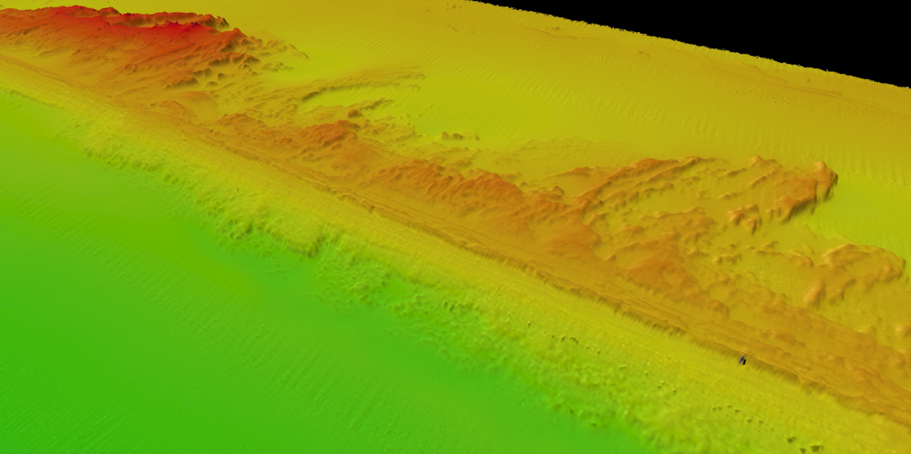 Drowned coastal dunes on the continental shelf, 60-100m below present sea level. These dunes were formed above water when sea levels were lower and were preserved as the coastline migrated over them thousands of years later. In mapping these drowned dunes and similar features, we uncovered new evidence of ancient coastlines. Orange and red colours indicate shallower areas, while green colours indicate deeper areas.
Data from CSIRO Marine National Facility. Map by Mike Kinsela
Drowned coastal dunes on the continental shelf, 60-100m below present sea level. These dunes were formed above water when sea levels were lower and were preserved as the coastline migrated over them thousands of years later. In mapping these drowned dunes and similar features, we uncovered new evidence of ancient coastlines. Orange and red colours indicate shallower areas, while green colours indicate deeper areas.
Data from CSIRO Marine National Facility. Map by Mike Kinsela
But to get a true feel for the multibeam system’s capabilities, we also mapped the wreck of the Limerick, a ship sunk by Japanese submarines off Australia’s east coast near Cape Byron in 1943. This also supported efforts to understand the current state of the famous shipwreck.
The wreck sits upside down in about 80m of water. To get a better view, we also lowered a camera to the torpedo hole in the side that sunk the ship.
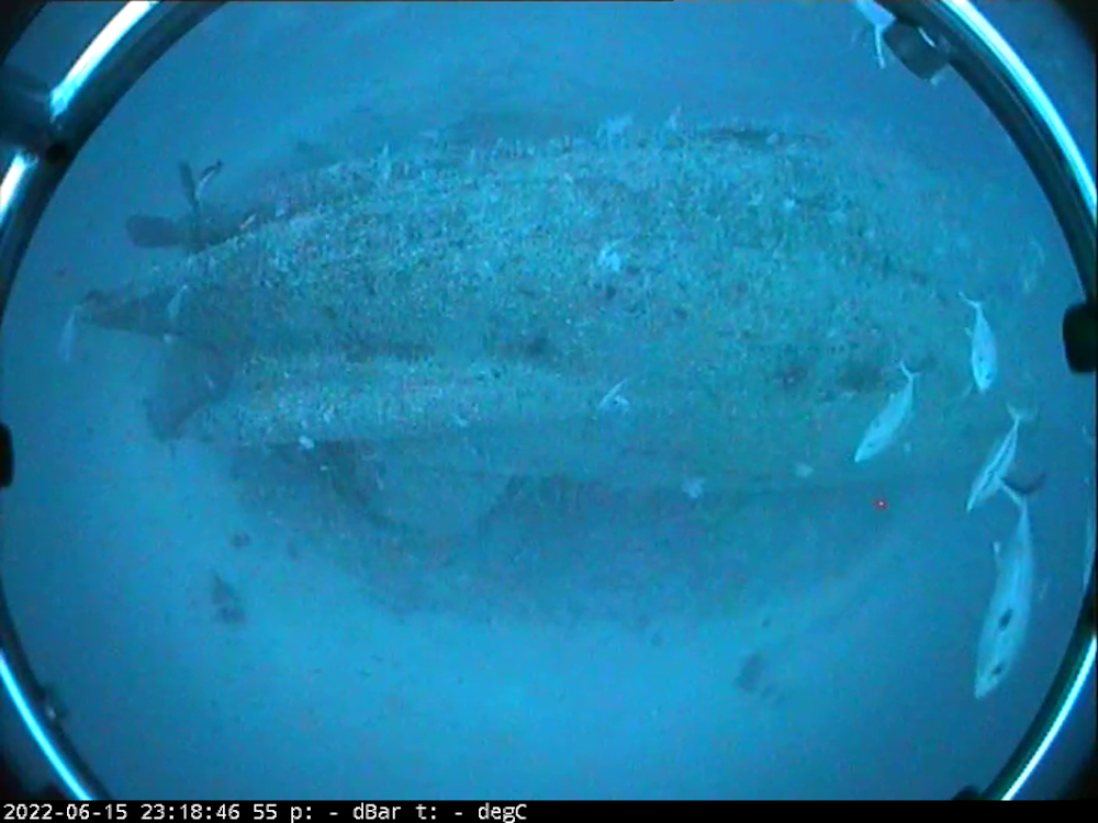 A downward looking image of the stern of the MV Limerick wreck collected using the towed drop camera. The MV Limerick sits upside down on the seafloor.
CSIRO MNF
A downward looking image of the stern of the MV Limerick wreck collected using the towed drop camera. The MV Limerick sits upside down on the seafloor.
CSIRO MNF
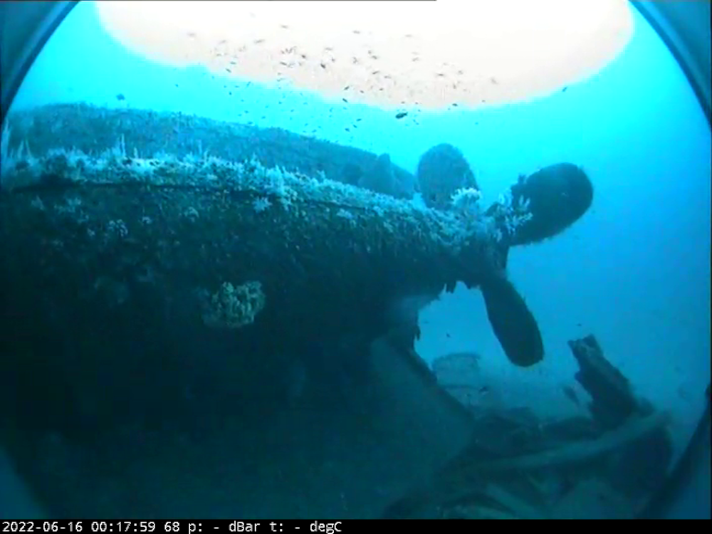 A sideways looking image of the stern of the MV Limerick wreck clearly showing the ships propellers.
CSIRO MNF
A sideways looking image of the stern of the MV Limerick wreck clearly showing the ships propellers.
CSIRO MNF
Beneath the seafloor
Understanding what’s on the surface of the seafloor tells us a lot about what has happened over the last few hundreds of thousands of years.
But looking below the surface at the sediment layers beneath can tell us how the seafloor has evolved over millions of years.
To do this, we use techniques that send out pulses of sound that can penetrate the seafloor. These pulses then listen for return signals that bounce off interfaces of different types of sediments and rocks.
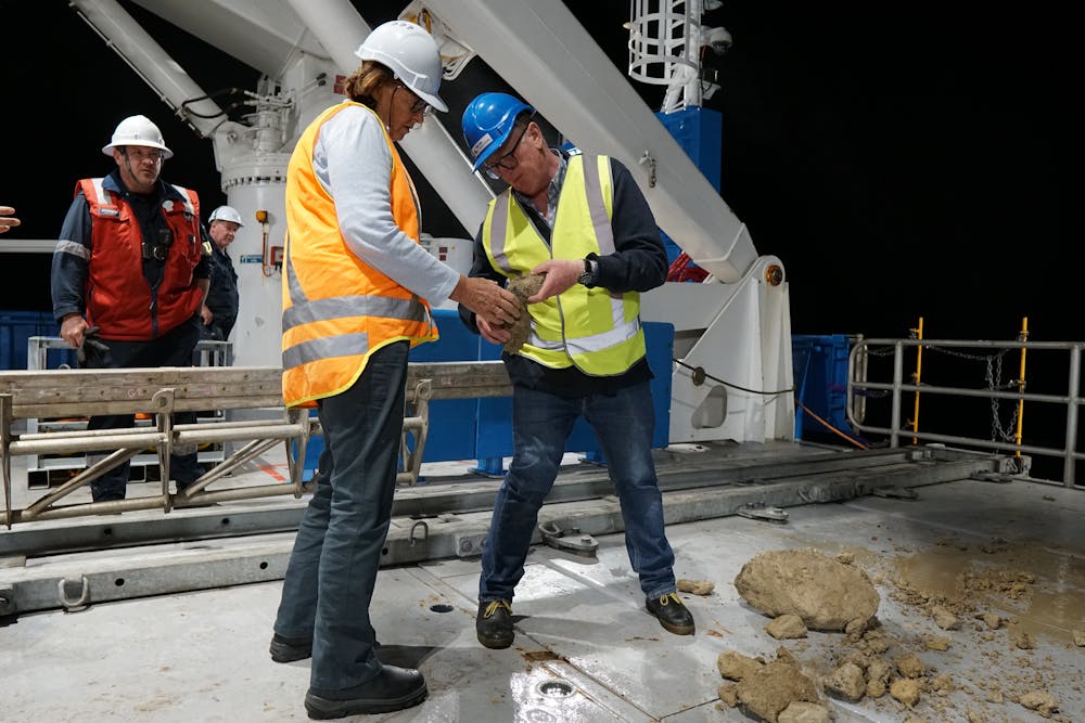 Samples being brought up from the seafloor is always a very exciting moment. Here, Chief Scientist A/ Prof Tom Hubble (right), inspects a freshly retrieved dredge sample late in the night at the end of his shift.
Ali Jam Productions Photography, Author provided
Samples being brought up from the seafloor is always a very exciting moment. Here, Chief Scientist A/ Prof Tom Hubble (right), inspects a freshly retrieved dredge sample late in the night at the end of his shift.
Ali Jam Productions Photography, Author provided
Through these sub-surface imaging techniques, we have identified a range of interesting features. These include extinct river channels that were previously above the sea surface when sea levels were much lower in the past.
But to really tie things down we need physical samples of the seafloor and the sediment beneath it. Doing this is a challenge when you’re floating kilometres above the seafloor you want to sample.
So we use deep sea sediment corers and dredges, lowered down on winches with kilometres of cable. Corers punch into the seafloor and bring us back a column of sediment, while dredges drag along the bottom pulling up bits of mud and rocks, bringing them on board in big chain baskets.
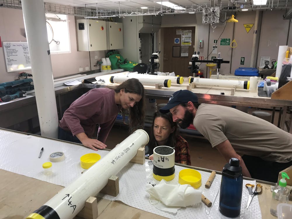 One of the goals of our voyage was to help train the next generation of marine geoscientists. Here, one of the 12 student volunteers, Ruby (left), discusses a freshly retrieved and opened core with principal scientists A/ Prof Hannah Power and Dr Mike Kinsela.
Murray Kendall, Author provided
One of the goals of our voyage was to help train the next generation of marine geoscientists. Here, one of the 12 student volunteers, Ruby (left), discusses a freshly retrieved and opened core with principal scientists A/ Prof Hannah Power and Dr Mike Kinsela.
Murray Kendall, Author provided
Once on board, these samples are carefully analysed to look for key features that will help us piece together the puzzle of the continental margin’s evolution. Further work, such as radiocarbon dating and isotope analysis, is conducted in the months to years after the voyage to complete the analysis.
We’ve collected some fascinating new data that will keep us busy for years to come, but we also had time for table tennis competitions, a few movie nights, and a daily debate on which of the many delicious meals onboard was the favourite.
And we can’t forget the many spectacular sunrises and sunsets!
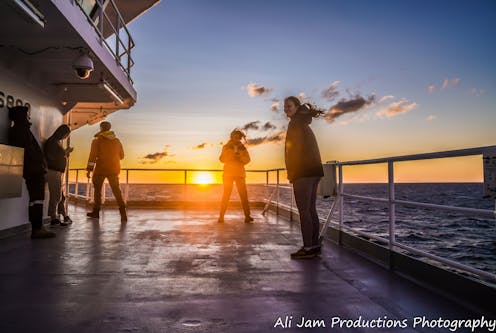
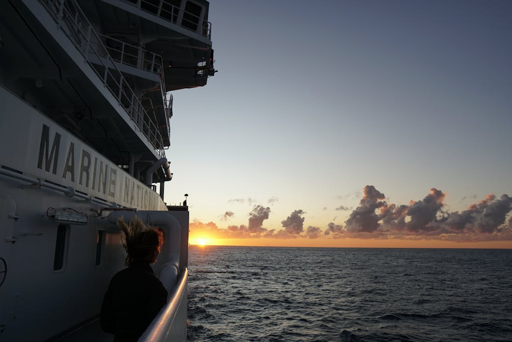 Sunrises at sea are unforgettable.
Hannah Power, Author provided
Sunrises at sea are unforgettable.
Hannah Power, Author provided
Authors: Hannah Power, Associate Professor in Coastal and Marine Science, University of Newcastle