Construction and Surveying: The Foundation of Modern Infrastructure
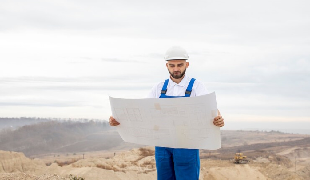
Precision and accuracy are the name of the game in construction. Construction and surveying are crucial disciplines that most public members remain ignorant about, even as construction projects pass around them daily. This discipline combines principles of traditional land surveying with the techniques required for the construction industry. It is essential to ensure that structures will be built to the precise location and specification.
Why is Construction Surveying So Important?
Construction surveying is essential to the building process, linking design to reality. Through the accurate measurement and mapping of construction sites, 3D technology can turn two-dimensional blueprints containing architectural ideas into three-dimensional physical structures with high precision. These include setting reference points and levels, site control to check the actual condition of the site, checking alignment and location of structures, construction monitoring, detection of deviations and accurate quantity calculations for materials and earthwork. Construction surveying is an essential step in the construction process. Without it, projects would be susceptible to errors, which can result in expensive mistakes, take a risk to safety on site and create bases for legal disputes.
Process of Surveying in Construction
Construction and surveying presents a wide range of dimensions from the construction lifecycle. It starts with a pre-construction survey, which includes site investigation, topographic mapping, boundary determination, property line check marking of existing structures and utilities, and providing control points and benchmarks. The layout survey is the next step, marking out building corners and lines, locating utilities and infrastructure, and determining whether to grade or excavate. As-built surveys document the precise position of completed buildings and utilities, ensuring they satisfy design specifications and providing reliable records for future developments. Finally, monitoring surveys measure the movement and settling of buildings during and after construction to ensure the building's long-term safety.
Advanced Technologies in Construction Surveying
Technology has changed the discipline of construction surveying. Today, the surveyor uses GNSS for high-precision position determination, total stations for accurate 3D measurements, 3D laser scanning for point cloud capture, UAVs for aerial survey coverage, BIM tools for integrated 3D modelling, and machine control systems in GPS-guided construction equipment. These add many advantages, such as helping to make it very accurate and efficient in handling data.
Like any other part of the construction process, construction surveying has challenges. Even with technological advances, construction surveyors face challenges. Top challenges include site and weather-related difficulties, high time pressure, communication with stakeholders, complicated survey data, and the complex regulatory environment governing construction and land use. Solving the above challenges will require technical knowledge, problem-solving abilities, and communication skills.
The Future of Construction Surveying
New trends and technologies drive the future of construction surveying. With Augmented Reality (AR) applications, you can visualise data collected from surveys and your design plan in real time. Artificial Intelligence (AI) and machine learning enable automation in data processing and predicting problems. IoT also becomes a driving force for the continuous monitoring of site conditions. Technology stacks based on mobile and cloud make it happen—moving data almost freely from field to office. This, alongside the advances of photogrammetry first pioneered through archaeological tech, empowers it with preciseness and mainstream access. Moreover, there is a growing trend of integrating construction surveying data into broader intelligent city initiatives, extending the reach of construction surveying data beyond single projects.
What is the Role of Construction Surveyor
As technology advances, the responsibilities of construction surveyors change. Modern surveyors must be technologically advanced, analytical, and detail-oriented communicators who can adapt to changing conditions. They help ensure the entire facility's construction safety, product quality, and efficiency with a process basis on which modern infrastructure stands. As for their industry, they are needed for everything from residential developments to skyscrapers, bridges, and highways.
The Intersection of Construction and Surveying?
Construction and surveying go hand in hand, depending on each other to accomplish the best results for the respective project. Everything about construction—including land selection and feasibility studies, design and engineering, execution of the construction plan, quality assurance during construction, and as-built documentation—reflects this symbiotic relationship. Surveyors give essential data that guide site selection, construction teams, and quality standards met and make accurate records of completed projects. Such close integration of surveying and construction practices is essential for the timely realisation of complex building projects today.
Surveying Instruments and Methods
Construction surveying encompasses a variety of methods and equipment, each appropriately used for its respective tasks and job-specific requirements. While these traditional methods, like traversing and levelling, are still in practice, they are also increasingly augmented or replaced by more sophisticated technology. Differential GPS systems outperform other positioning methods in accuracy, offering centimetre-level precision for most projects. At the same time, robotic total stations have made it possible to operate solo and collect data with the push of a button. 3D laser scanners are set instruments that generate millions of data points to create incredibly detailed models of existing structures and terrain. Ground Penetrating Radar (GPR) spectrum and analysis of GPR data: GPR measures terrestrial electromagnetic waves in the gigahertz frequency range according to Figure. For an overview, once the waves are emitted into the ground, as shown in the cross-section by emitting pulses of downward-directed electromagnetic energy, these frequencies reflect off materials inside the earth before returning. Together with data processing and analysis software, these tools empower surveyors to capture and interpret large quantities of spatial data faster and more accurately than ever.
Quality Control and Accuracy in Construction Surveying
Construction surveying will always have to adhere to a high standard of accuracy since even the smallest of mistakes can create significant gaps in construction. The bulk of the work is to confirm the integrity of data using different quality controls by the surveyors. This implies frequent calibrations, redundant measurements, and checkpoints to verify correctness. Survey data is subjected to statistical analysis to help find and eradicate mistakes. In addition, following standards and best practices, including but not limited to the guidelines or posts of professional organisations like the American Society for Photogrammetry and Remote Sensing (ASPRS) or the International Federation of Surveyors (FIG), is essential if quality is to be preserved. The execution of quality management systems and stringent documentation procedures ensures the enhanced reliability of survey outcomes.
Conclusion
Construction and surveying are the marriage between accurate measurement and applied construction. They are a discipline that combines ancient principles with the latest technology, profoundly impacting our built environment. In an age where construction projects are larger and more ambitious than ever, accurate, reliable surveying will only become increasingly crucial.
A thorough understanding of surveying fundamentals and methodologies is an asset if you work in the construction industry. And just like that, surveyors with a sound grasp of the construction process can provide meaningful, time-sensitive information sooner than ever.
With a focus on the future, combining pioneering technology with traditional surveying knowledge will only improve construction projects through precision, experience and capability. Whether it be a minute residential development or the most significant infrastructure project, this very construction surveying will always remain that invisible backbone, keeping our places where they need to be: standing tall, straight, and accurate.


