Become a beach scientist this summer and help monitor changing coastlines
- Written by Mitchell Harley, Scientia Senior Lecturer, UNSW Sydney
When you arrive at your favourite beach these summer holidays, you may notice something different about the coast.
With the triple-dip La Niña now making way for El Niño, our beaches have been through a rollercoaster ride. Some beaches have been completely stripped of sand, while others have grown very wide.
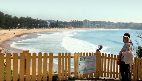
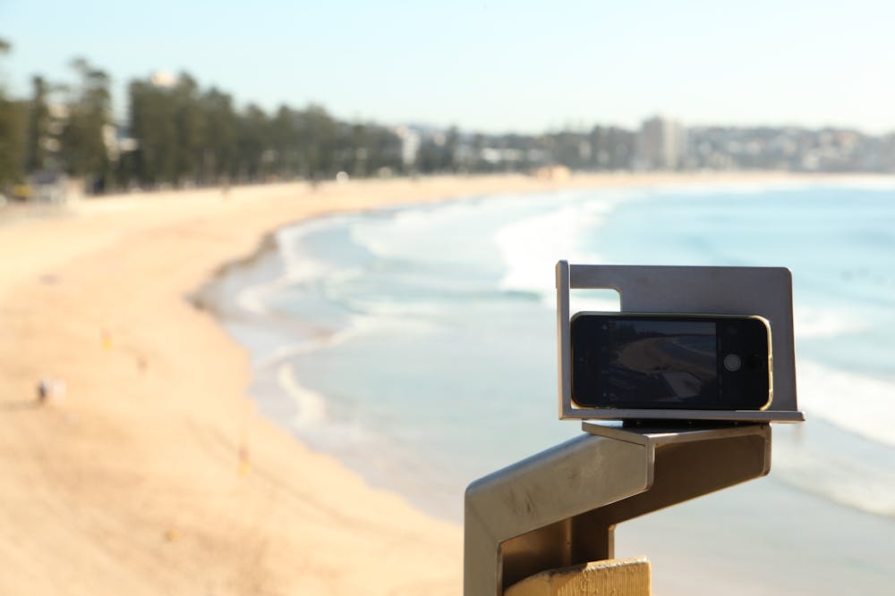
In the past, such changes went mostly unrecorded. However, thanks to a project known as CoastSnap, coastal data is now being collected like never before. Using designated camera cradles installed at beach viewpoints, CoastSnap uses community snapshots taken on smartphones to track beach change.
Almost 50,000 photos have been collected so far. They have revealed a varying picture in recent years: from dramatic beach loss during La Niña storms three years ago, to 60 metres of beach growth in recent months. So with smartphones as commonplace as towels and sunscreen in the beach bag, why not add coastal data collection to your list of holiday activities this summer?
Turning beach snaps into scientific data
Through CoastSnap, we installed a network of stainless-steel camera cradles along coastal trails all around the world. These camera cradles are positioned at a perfect vantage point for tracking changes to the coast – whether it be due to rising sea levels, extreme storms or other factors.
All you need to do is place your camera in the cradle, take a photo and upload it using the QR code at the station. Because the position and angle of the photo is always the same, over time these snaps reveal how the beach is changing.
As well as being a powerful visual record, sophisticated algorithms turn each photo into miniature satellite images that are used to precisely measure shoreline position. This is done using a process known as photogrammetry, in which pixels in the image are rearranged as though they had been taken from space.
This aerial view enables beach change to be easily measured. Also, since the exact time of photo capture is recorded, the effects of tides as they vary throughout the day can be accounted for.
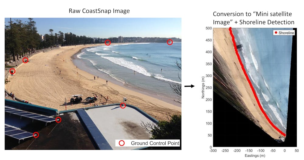 CoastSnap photos are converted to a miniature satellite image using a process known as photogrammetry.
Mitchell Harley
CoastSnap photos are converted to a miniature satellite image using a process known as photogrammetry.
Mitchell Harley
From local to global: a network of community beach monitoring
From its beginnings on the Northern Beaches of Sydney in 2017, new CoastSnap stations have been rolled out all around the world. We now have more than 350 CoastSnap stations in 31 countries and across five continents.
This makes it the largest coordinated network of coastal monitoring worldwide – and all the data is collected by the community.
In Ghana, West Africa, students from local schools are using CoastSnap to better understand how the “golden seaweed” sargassum impacts fishing communities.
On Prince Edward Island in Canada, CoastSnap captured the damage done by Hurricane Fiona last year. The same stations are now being used to track the post-hurricane dune recovery.
In Australia, there are currently 125 CoastSnap stations around the country. This enables a big-picture assessment of the coastal consequences of large-scale weather events. For example, during last year’s record rainfall in eastern Australia, extreme erosion was observed at CoastSnap stations from Queensland to southern New South Wales. The images reveal scouring by floodwaters was the main cause of beach erosion in many locations, rather than wave action as is usually the case.
Monitoring the present to plan for the future
Data on coastal change is crucial for managing coastlines into the future. This is particularly important as sea levels continue to rise, storm tracks shift, and beaches come under increasing pressure from overdevelopment.
With several CoastSnap stations already operating for over six years now, this growing record is beginning to observe longer-term changes to the coast. This data is being fed into numerical models that help coastal researchers predict what the coastline will be like in the coming decades – and plan accordingly.
Smart coastal planning will help buffer climate change impacts. This will go some way to ensure future generations can enjoy the coast like we do today.
So as you head out to the beach this summer, look out for your nearest CoastSnap station and help monitor the coastline – it really is a “snap”!
Read more: Storms or sea-level rise – what really causes beach erosion?
Authors: Mitchell Harley, Scientia Senior Lecturer, UNSW Sydney