
What’s driving north Queensland’s deadly, record-breaking floods?
- Written by: Steve Turton, Adjunct Professor of Environmental Geography, CQUniversity Australia
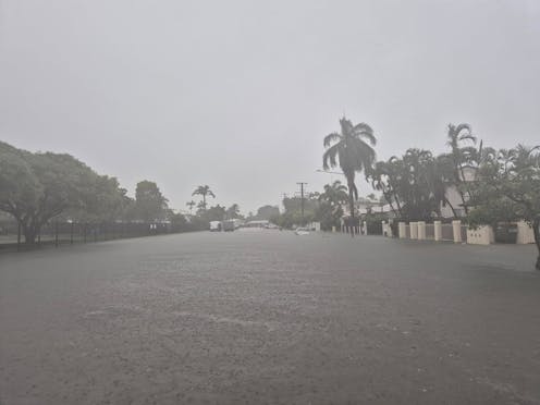
Record-breaking floods across north Queensland have now turned deadly, with one woman drowning while being rescued on Sunday morning. And the floodwaters are still rising, with rain set to continue.
Over the 48 hours to Sunday, there were reports of up to 1 metre of rainfall in parts of northeast Queensland. The torrential rain continues, particularly in the Herbert Coast region and north to around Tully.
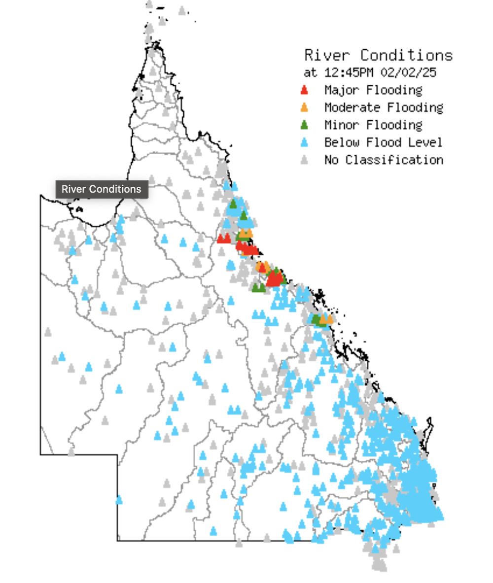
Residents of Ingham and nearby towns, about 100km from Townsville, are witnessing flooding from the nearby Herbert River. This morning, it was at 15 metres and rising. With more heavy rain forecast for the next 24 hours, the Herbert River is likely to break the 1967 record of 15.2 metres later today.
Queensland Premier David Crisafulli – who grew up on his family’s sugar cane farm in Ingham – has said the floods will be a “once in a century” event for the town. To make matters worse, authorities say the town has lost power and an extended outage is likely.
The atmospheric factors behind these floods are very similar to recent floods in the region – and climate change is no doubt playing a role.

Where are the floods hitting?
For many people in Townsville – the largest city in Northern Australia – the unfolding emergency will bring back memories of the devastating February 2019 floods, which caused A$1.24 billion in damage. Residents have been asked to evacuate from several low-lying suburbs which were inundated in 2019.
 Authorities in Townsville asked all residents in the low-lying black zone to evacuate by midday Sunday February 2. Floodwaters could reach second-storey heights in this zone. Residents in pink suburbs have been asked to be on standby.
Townsville Council, CC BY
Authorities in Townsville asked all residents in the low-lying black zone to evacuate by midday Sunday February 2. Floodwaters could reach second-storey heights in this zone. Residents in pink suburbs have been asked to be on standby.
Townsville Council, CC BY
It is too early to say if this flood event will be worse. Fortunately, water levels in the city’s Ross River Dam are much lower than 2019. Townsville Airport has recorded 545mm of rain over the past 48 hours, with many northwest suburbs recording much higher levels. The township of Rollingstone – 60km northwest of Townsville – recorded a whopping 702mm over the 24 hours to 9am Sunday.
Further north in the Cairns to Daintree region, residents are watching with concern, with many still raw after the record-breaking floods of December 2023.
 In February 2019, floods devastated parts of Townsville. Insurers put the cost at A$1.2 billion.
Dan Peled/AAP
In February 2019, floods devastated parts of Townsville. Insurers put the cost at A$1.2 billion.
Dan Peled/AAP
What’s behind these floods?
The ongoing 2025 extreme rainfall event, the 2019 Townsville floods and the 2023 Cairns and Daintree floods are remarkably similar in many ways.
What triggered each of these floods was prolonged heavy rain falling on the southeast flank of a stationary tropical low weather system. Normally, tropical lows bring wind and rain, but move through quite quickly. But in recent years, we have seen a tendency for these systems to stall, sitting in place over or near land and dumping huge volumes of rain.
Last week, the Bureau of Meteorology warned that five tropical lows were forming around northern Australia. Most tropical cyclones form from tropical lows embedded in the region’s monsoon trough, a large low pressure band which forms over summer and draws in warm, moist air from the adjacent tropical seas.
But significant rain events like this one don’t necessarily require a tropical cyclone. Slow-moving deep monsoon lows over land can also deliver huge amounts of rain and widespread flooding.
These atmospheric conditions allow intense rain bands to form between converging winds: warm, moist winds from the northeast and southeast winds originating from the Coral Sea. As the winds collide, they push the moist air up into the cooler parts of the atmosphere where it condenses and falls as torrential rain.
More extreme rainfall and higher frequencies of flooded rivers and flash floods around the world have a clear link to climate change and ongoing global heating.
The main drivers behind these events include warming of the atmosphere. For every 1°C of warming, the atmosphere holds 7% more water vapour. Recent research suggests this figure could be even higher for short duration rainfall.
Hotter oceans hold more energy, meaning they can also amplify the global water cycle when atmospheric conditions are suitable.
This year’s latest ever monsoon
This year, sea surface temperatures in the northwest Coral Sea are 1-2°C above average. Ocean temperatures have risen because of a lack of cloud cover and rain last month. In northwestern Australia, this has given rise to an intensifying marine heatwave.
This ocean heat is likely to be driven by the Australian monsoon’s latest ever arrival. The monsoon brings heavy rains to northern Australia, triggering the wet season. When it arrives, sea surface temperatures generally drop due to a combination of high cloud cover and the cooling effect of rainwater.
After a slow start, the North Australian monsoon season is now in full swing.
The Bureau of Meteorology is monitoring an active monsoon trough for any low pressure systems, which may develop into tropical cyclones over the next week or so. If any cyclone does form, it will gain energy from warmer than usual sea surface temperatures.
What’s next for north Queensland?
The flood emergency in north Queensland is far from over. All global circulation models predict heavy rain to continue in the region, extending up towards Cape York and the Gulf Country as an active monsoon surge moves in from Indonesia.
As river catchments get saturated, more and more water will run off and engorge rivers. Forecasts are for rain to continue well into tonight and the next few days. We are likely to see more flooding in more places this week.
For the latest updates, check the Bureau of Meteorology’s Queensland flood warnings, ABC Emergency or local ABC radio stations.
Authors: Steve Turton, Adjunct Professor of Environmental Geography, CQUniversity Australia
Read more https://theconversation.com/whats-driving-north-queenslands-deadly-record-breaking-floods-248847